
Regional Climatologist Says 2023's Atlantic Hurricane Season Will Be 'Close to Normal'
KINGSTON, Jamaica – Regional forecasters are predicting 17 named storms, seven of which are likely to become hurricanes with four of them being major storms this year.
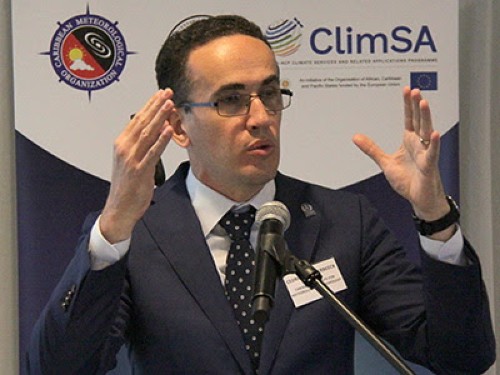 Ceìdric Van Meerbeeck (CMC Photo)However, the Barbados-based Caribbean Institute for Meteorology and Hydrology (CIMH) said the “boxing game” between the Atlantic and Pacific Oceans as well as the Saharan dust over the Atlantic would determine the level of tropical cyclone activity.
“The Atlantic hurricane season outlook (is) close to normal,” CIMH climatologist Dr. Cédric Van Meerbeeck, told the 2023 Wet/Hurricane Season Caribbean Climate Outlook Forum (CariCOF) here, adding “to me, It says one storm is enough.
“So when you see ‘close to normal’, that is never for us to tell you to stop being vigilant. Rather it’s the opposite. We already know that in a normal year we get affected really badly,” Van Meerbeeck said.
“Fortunately, I can say that there’s just a tiny, tiny, tiny bit of chance that we’re gonna get a very active season. It’s more likely that it is going to be close to normal.”
He said the season is highly likely to be normal because of the “boxing game” in which the El Niño phenomenon in the Pacific Ocean is bringing down storm activity whereas the warm Atlantic temperatures will try to drive up storm activity.
“So, if they fight together, the result is a tie. Essentially, that’s what we’re saying,” Van Meerbeeck said, noting that the hurricane season forecasts improve as the season progresses.
“Now, we know El Nino is coming and now it’s easier to forecast hurricanes. So when you look at these predictions, do not discard them. That’s not what I’m saying. But look out for their next update because they will be much more confident,” he said.
Van Meerbeeck said regional forecasters have high confidence in the number of named storms, and medium confidence in the number of hurricanes and major hurricane forecast.
He said the CIMH will issue its next major forecast update in early August, just ahead of the peak of the hurricane season.
“Why am I saying to look out for an update? Because things change,” Van Meerbeeck said, noting that last year, regional forecasters had expected an active season but this did not materialize.
“From the second of July until the end of August, there was no single storm in the Atlantic. And that is because we had a lot of Saharan dust coming over from Africa,” Van Meerbeeck said, adding that forecasters cannot predict Saharan dust way in advance.
The climatologist said that the Saharan dust, that came to play a role, “a good rule because it proved my forecast wrong in that it reduced the activity of the hurricane season but something that we can’t as yet predict.
“We can predict the occurrence of Saharan dust up to about two weeks in advance confidently, but not three months, not six months.
“So that’s a reality. That’s a caveat of our forecast. Still, if you were to remove that period from July to August, did the second part of the season fear any better? Well, we have forecasts that range of six to 12 with the best estimate forecast of 10, and there were indeed 11 storms so it’s not like our forecast never work is just that number one factor, Saharan dust, we simply can’t forecast,” Van Meerbeeck
“So, close to normal, but as you can see, it could go a little bit worse, it could go a little bit better. If El Nino wins the battle. What is it gonna be? Better or worse? A bit better. If the Atlantic wins the battle, what is it gonna be? A bit worse.”
He said that forecasters are also looking at the Accumulated Cyclone Energy (ACE), which is the amount of heat that is displaced by storms.
Van Meerbeeck said it is sometimes important that the region has big storms “because they remove the energy from our region, as long as they don’t remove it and place it on our islands.
“So in some years, like 2017, Irma, in particular, was a new record in terms of the amount of energy displaced, but dumped onto our islands,” he said, adding that the average ACE score is 123, but this year it is projected to be 120.
“Why was it a little bit lower than average? Because back in April, the Atlantic hadn’t warmed yet. So that battle was not going on yet. They had not seen that happening yet. Now we know it’s there. Nevertheless, it’s very unlikely that we’re gonna get such an amazing amount of, or such a frightening amount of energy displaced by storms as we did in 2017 or 2020.”
He said he hoped that from this perspective the Barbados-based Caribbean Disaster Emergency Management Agency (CDEMA) would get some kind of encouragement.
“… even though we can’t forecast where the storms will happen, there is a chance that damage might be a little bit more on the lower side, simply because the overall activity is a bit more,” ,” Van Meerbeeck said.
He said the Bill Grey forecast is that there is a 49 per cent chance that at least one major hurricane will pass through the Caribbean this hurricane season.
“That’s why I say one is enough,” Van Meerbeeck said, adding, “I will pray or we can only hope that it will not hit any of our islands and that it does not even manifest.
“If there’s one forecast I always love to be wrong as the hurricane season forecast. But let’s be ready.”
He noted that while the Atlantic Hurricane season runs from June 1 to November 30, there was a named storm in January.
“Fortunately, it didn’t affect us except a few swells, maybe, here and there. But that means that yes, we have a hurricane season which we characterize as the time of the year when it’s most frequent or most active,” Van Meerbeeck said.