
Jamaica Hosts Workshop to Improve Hurricane Damage Assessment
KINGSTON, Jamaica – The global conservation organization, The Nature Conservancy (TNC), says it has conducted a workshop in Jamaica that focused on the fundamentals and applied use of remote sensing to evaluate hurricane impacts on coastal and marine ecosystems, using PlanetScope and Sentinel-2 satellite imagery.
 It said that the training responds to a growing need for rapid, accurate and scalable tools to assess environmental change as extreme weather events increase frequency and intensity across the Caribbean. Jamaica was hit by a category five hurricane Melissa last October resulting in damages estimated at US$9.9 billion. At least 45 people died as a result of the storm.
The workshop brought together more than 60 government stakeholders with responsibility for reporting on coastal wetland targets in Jamaica’s Nationally Determined Contributions, non-governmental organizations (NGO) stakeholders who manage protected spaces, as well as local conservation practitioners and scientists.
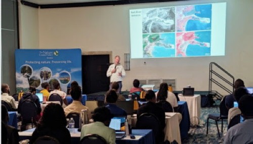
Led by the Caribbean lead scientist, Dr. Steve Schill and other experts at TNC, the workshop combined theory, hands-on analysis and real-world case studies to strengthen the link between satellite data and field-based decision-making.
“ Participants were exposed to the basics of field data collection and integration, and shown how to easily access satellite imagery and other mapping tools available from both public and private sources. They also learned how to combine satellite information with field data, using a variety of widely available software platforms.”
The TNC said that the training included demonstrations of cloud-based tools such as Google Earth Engine, with real examples showing how these technologies support faster, more accurate change detection assessments.
“Remote sensing enables us to detect hurricane impacts in a matter of days. With drones, we can map damage as soon as the weather permits”, said Schill, adding that by combining satellite and drone imagery with on-the-ground observations, the workshop strengthened the technical capacity needed to make timely, science-driven decisions that support coastal recovery, restoration and resilience.
The workshop also allowed for participants learning to process and analyse satellite imagery using popular mapping software such as ArcGIS Pro and QGIS. NGO stakeholders and other participants learned by using Kobo Toolbox and Google Earth Pro.
“Reliable and timely environmental data is vital for translating post-disaster assessments into appropriate policy and investment decisions,” said Donna Blake, the TNC Jamaica programme director.
“Strengthening the technical capacity of resource managers and practitioners ensures that disaster response and restoration efforts are grounded in evidence and aligned with national long-term resilience goals.”
The workshop was part of the project Integrating coastal wetlands into Jamaica’s Nationally Determined Contributions and is funded by the Pew Charitable Trusts.